The boring Kuiper Initiative
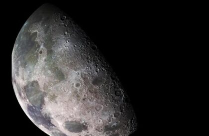
In 1955, astronomer Gerard Kuiper approached his colleagues with the idea of creating photographic atlases of the Moon, but found support from only one person. This reflected little interest in the Moon among the astronomical community, since telescopes were designed to study distant objects, and the Moon was considered boring and uninteresting. Maps were made by geologists, not astronomers.
However, Kuiper continued his work, transferring it to the University of Arizona, where he could take advantage of clear skies and mountain peaks. As early as 1961, the US national goal was to put a man on the Moon, and mapping the Moon became a national priority.
The Kuiper Lunar and Planetary Laboratory began producing high-quality images of the Moon using special telescopes. Subsequently, they also used images of the Moon taken from the robotic spacecraft to create more complex atlases of the lunar surface.
How the “Corrected Lunar Atlas” was created?
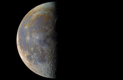
Initially, lunar atlases created by the Lunar and Planetary Laboratory were based on the best images obtained using telescopes. However, the team realized that great things could be achieved. One problem was that even on the side of the Moon that always faced Earth, distant regions appeared distorted.
To solve this problem, they came up with a unique method. They created a large white ball, three feet in diameter, and onto this ball they projected a high-quality telescopic image from the corridor. As they traveled around this model world of the Moon, elements of its surface appeared before them as if they were observing it from above. As we approached the edges of the visible side of the Moon, the shapes of the details became clearer: ovals turned into circles, and wavy lines acquired additional detail. This idea, although previously considered, led to the creation of the Revised Lunar Atlas.
Insights from a graduate student while traveling around the globe
Graduate student William Hartmann, traveling around the globe to take “corrected” images, noticed that on one edge of the Moon there was a feature now known as the Eastern Sea. It is very similar to many of the basins that have been well studied and known to telescopic observers. But it had some significant differences.
It contained fewer impact craters from later times, suggesting that it was younger and better preserved. It also had a distinct bull’s-eye appearance, with concentric mountain ridges forming rings. Hartmann realized that this might be what all these basins once looked like, before later impact craters and lava flows blurred the details. The idea of huge impacts eventually led Hartmann and others to propose that the Moon was formed by a giant impact with the Earth, an idea that still underpins leading theories of the Moon’s origins.
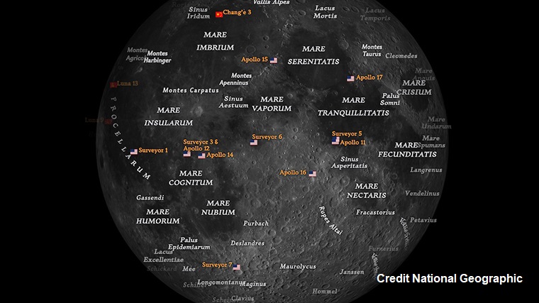
Apollo precision landing map
A significant moment in the history of telescopic imaging in the Apollo program involves Ewan Whitaker, a modest Englishman who, in response to a request from Gerard Kuiper, came to the United States in 1955 and joined his team in Arizona.
When the robotic Surveyor 1 spacecraft became the first American mission to soft-land on the Moon in 1966, the mission team made a mistake in determining the exact location based on photographs. However, Whitaker used the best telescopic images, analyzed which hills and directions should be visible, and correctly determined the mission’s location to within a few miles.
After Apollo 11 landed on the Moon, NASA wanted to use Apollo 12 to prove that it could precisely target a specific location based only on latitude and longitude. To do this, you need to know exactly the latitude and longitude of a place.
NASA tasked Whitaker with finding the exact location where another unmanned Surveyor, Surveyor 3, had landed. Whitaker gave his best estimate, and Apollo 12 went after it. The astronauts couldn’t see Surveyor 3 along the way because it was in the shadows. When they looked around after landing, they found they were within walking distance of it after a journey of 240,000 miles.

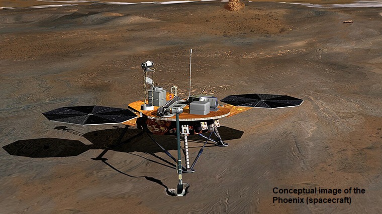
Why map Mars and asteroids?
Although modern photographs of the lunar surface taken from orbiters have surpassed the maps of the Moon created by the Lunar and Planetary Laboratory, the organization founded by Gerard Kuiper continues its research.
For more than a decade, orbiters landing on Mars have used HiRISE (High Resolution Imaging Science Experiment) images from the Lunar and Planetary Laboratory to select landing sites. Large and powerful, HIRISE’s camera captures images covering vast areas of the Martian terrain, while allowing details as small as a kitchen table to be seen.

The robotic spacecraft OSIRIS-REx, also sent from the Lunar and Planetary Laboratory in 2020, is currently returning from the asteroid Bennu. He mapped its surface in order to select a site to take a sample. Landing on Earth with samples of rock and dust from the asteroid will take place on September 24, 2023. OSIRIS-REx will land in the Utah desert.
These maps play a key role in space missions.
Image credit:
https://nerdist.com
https://en.wikipedia.org
https://www.nasa.gov
https://mars.nasa.gov