Sand constantly moved by winds covers the surface of Mars, forming a dynamic desert landscape with dunes of varying heights and shapes. Over the past ten years, thanks to images from NASA’s Mars Reconnaissance Orbiter’s HiRISE instrument, scientists have studied the planet’s dunes in great detail.
Images of windswept dunes taken from orbit provide a tantalizing peek into Martian weather. Credit: NASA/JPL/University of Arizona
Linear dunes (above) are sculpted by winds blowing from one or two slightly different directions, and can extend for more than 100 miles (160 km). Credit: NASA/JPL/University of Arizona
Barchans (above) are crescent-shaped dunes formed by winds traveling in one direction. The crescent’s two ends point in the direction of the wind. Credit: NASA/JPL/University of Arizona
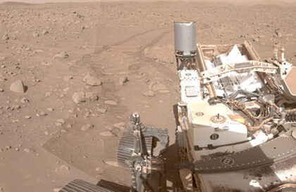
Scientists observing a global dust storm on Mars in 2018 using NASA’s Curiosity rover found that despite strong wind gusts, sand movement did not increase. This raises the mystery of wind behavior on Mars.
Winds that raise dust in the atmosphere and surface winds act differently. Some researchers theorize that dust kicked up during a global storm blocks sunlight and stops the formation of surface winds typically caused by temperature fluctuations between the air and the planet’s surface.
Scientists studying the movement of sand dunes on Mars believed that only strong winds during global dust storms could move them, especially given the low pressure in the planet’s atmosphere. Mars’ ultra-thin atmosphere makes winds of 100 mph (160 kph) feel like a breeze. However, decades of observations have shown that Martian sand is constantly moving, even without strong winds, which surprised researchers.
Researchers are analyzing the entire surface of Mars to see if Curiosity’s Gale Crater is unique, primarily since the storm’s center was located above Opportunity, which was on the opposite side of the planet. Scientists also consider that the wind inside Gale Crater may act differently. The crater may have provided cover for Curiosity.
This oblique, sord-looking view of Gale crater shows the landing site and the mound of layered rocks that NASA’s Mars Science Laboratory will investigate. The landing site is in the smooth area in front of the mound (marked by a yellow ellipse, which is 12.4 miles [20 kilometers] by 15.5 miles [25 kilometers]).uthwa
Gale crater is 96 miles (154 kilometers) in diameter and holds a layered mountain rising about 3 miles (5 kilometers) above the crater floor. Credit: NASA/JPL-Caltech/ASU/UA
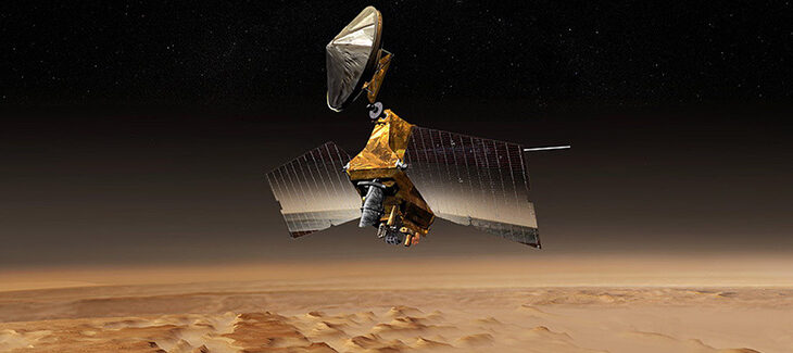
Banner image: The HiRISE instrument aboard the Mars Reconnaissance Orbiter spacecraft has collected images of Mars since 2006. Credit: Spacecraft image courtesy of NASA
Image credit:
https://svs.gsfc.nasa.go
https://mars.nasa.gov
